Extreme Climate Risk in Zhejiang Forests: Regional Clustering and Climate Forcing for Landscape Models
Fudan University
Jun 2025 – Mar 2026
Research question: How can regional climate projections be translated into climate-risk profiles and forcing inputs for forest landscape models?
Abstract
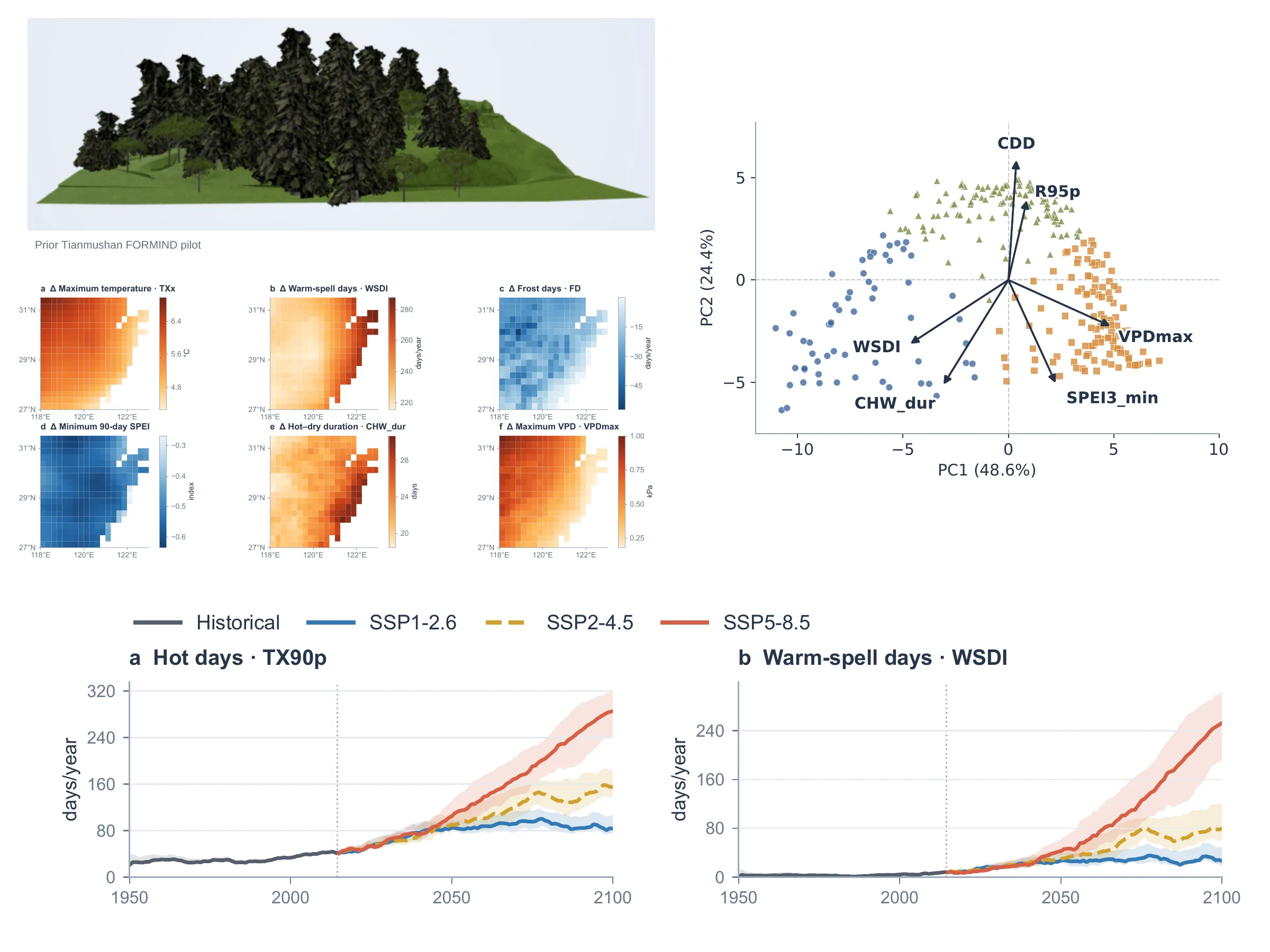
Regional climate projections capture changes in extreme events, but translating these projections into forest landscape simulations requires a tractable representation of climatic exposure and local terrain. Here, we developed a workflow for regional climate-risk characterization and climate-forcing preparation in Zhejiang and its surrounding region. Using NASA NEX-GDDP-CMIP6 data from four global climate models, we calculated 16 extreme climate indicators across 289 retained grid cells. Ecologically weighted principal component analysis reduced 32 change features under SSP2-4.5 and SSP5-8.5 to six components explaining 90.1% of the variance. K-means clustering identified three climate profiles, with a silhouette score of 0.387. Under SSP5-8.5, changes for 2081–2100 relative to 1995–2014 distinguished a profile with longer compound hot-dry events (+26.8 days), a profile with stronger extreme warming and atmospheric dryness (+6.2°C in annual maximum temperature and +0.74 kPa in maximum vapor pressure deficit), and a profile with longer dry spells (+11.9 days). Values represent cluster means of four-model median changes. Independently, we prepared 216 climate-forcing databases for six predefined nature reserves, spanning three emission pathways, precipitation sensitivity settings and 80 elevation bins. These outputs characterize contrasting patterns of climatic exposure and provide inputs for subsequent forest-model experiments. Calendar and bias-correction validation, together with iLAND simulations of forest growth, mortality and carbon dynamics, remain the next steps.